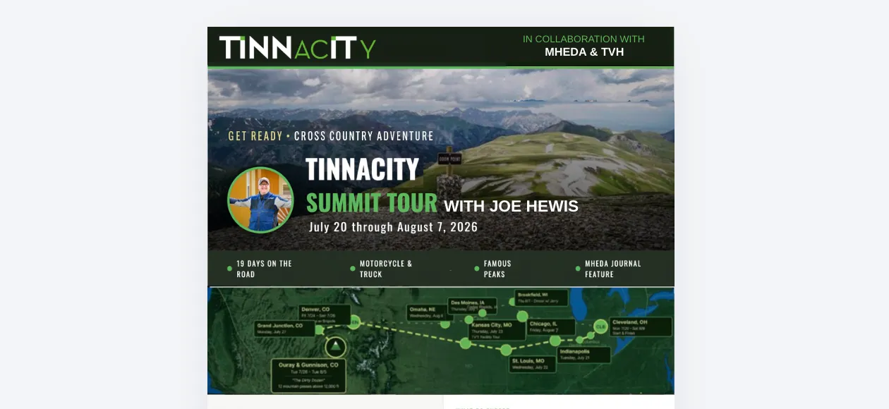
Tinnacity Summit Tour 2026: climbing mountains with material handling leaders.

Joe Hewis, Tinnacity's Director of Sales, crossed the country by truck and motorcycle from July 20 through August 7, 2026 β€” behind the scenes with top equipment dealers and industry leaders, then eight days on two wheels over the Colorado high country.

Tinnacity Summit Tour 2026

Join Joe Hewis, Tinnacity's Director of Sales, as he embarks on an epic, cross country journey by truck and motorcycle from July 20 through August 7, 2026.

The Tinnacity Summit Tour isn't just about logging miles, it's about uncovering the stories of resilience, grit, and innovation that drive the material handling industry. At every stop along the route, Joe is going behind the scenes with top equipment dealers and industry leaders to tour their facilities, conduct live interviews, and ask one foundational question:

β€œWhat is the biggest mountain your business has had to climb, and how did you get to the top?”

The question at every stop

From the flatlands of the Midwest to conquering 12 iconic mountain passes above 12,000 feet on his Husqvarna 901, Joe is capturing real time insights on how modern dealerships overcome operational obstacles, manage field technician logistics, and leverage technology to scale.

Follow the journey live: bookmark this page for real time dispatches from the road, exclusive executive quotes, and facility tours. This entire journey will culminate in a featured cover story for the prestigious MHEDA Journal, and you have a front row seat to the raw, unedited insights as they happen.

Day 1: Cleveland, Columbus, Dayton, and into Indiana.

What started as one guy, one truck, and a motorcycle crossing the country turned into something much bigger. Joe Hewis and Michael Simon are kicking off the first leg of the tour together, spending the next stretch on the road meeting the dealers, MHEDA members, and industry leaders who actually make this business run, one handshake and one shop floor at a time.

Day 1 of the Tinnacity Summit Tour is officially in the books! From Cleveland stops and a Columbus lunch with friends, to a little highway trailer drama and a Dayton visit to connect with new clients, it was an action-packed start. Scroll down to see how it went. πŸ‘‡

Joe logged serious miles across Ohio today, hitting key dealer stops, catching up with old friends over lunch, overcoming a little highway drama, and crossing into Indiana by nightfall: Cleveland, then Columbus, then Dayton, then Indiana.

Stop 1: Conveyor & Caster, Cleveland. We owe a huge thanks to the team at Conveyor & Caster for hosting us in Cleveland, along with Lauren Reed (MHEDA) and John Gelsimino (All Lift Service Co. Inc.) for joining the visit!

Joe spent time with Tim Austin and Jeff Stohr from Conveyor & Caster and John Gelsimino from All Lift Service Co., while Lauren Reed from MHEDA facilitated incredible roundtable discussions.

Stop 2, Cap City Diner: grabbing lunch with industry friends and colleagues. It was awesome connecting with Jim Ripkey, Dave Tinnerman, and Brady Fleming over a classic diner experience at the Cap City Diner. 🍽️

Joe stopped in Columbus for lunch and great conversation. Brady Fleming was unpictured, so was he really there, or was he a ghost guest? We'll let you decide.

No road trip is complete without a little adventure. Trailer fender issues on the highway! Luckily, when you're in the material handling industry, you're never far from help. Huge shoutout to Jim Smith for getting the rig fixed and back on the road.

Stop 3, Miami Industrial: a fantastic stop in Dayton. We were also thrilled to stop by Miami Industrial Trucks, Inc. in Dayton to visit our new clients and spend time with their team, Cameron Jones and Jay Marshall.

Ohio's in the rearview, and Indiana, we're on our way. The team is crossing into Indiana tonight to recharge. Bright and early tomorrow, Day 2 kicks off with fresh stops across the Hoosier State.

Indiana is up next. Stay tuned. 😎

Click any photo to view

Tim Austin, Jeff Stohr, Lauren Reed, John Gelsimino and Joe Hewis holding the Summit Tour flag in front of an open service van at Conveyor & Caster
Dave Tinnerman, Michael Simon and Jim Ripkey standing beside the Summit Tour truck in the Cap City Diner car park
A damaged trailer fender with tools spread across the tarmac, and Joe Hewis standing with Jim Smith after the roadside repair
Joe Hewis and Michael Simon holding the Summit Tour flag with the Miami Industrial Trucks team outside their building
Joe Hewis, Brian Robison and Michael Simon at the open trailer with the motorcycle loaded inside

Day 2: Indianapolis and the long haul to St. Louis.

Joe and Michael kicked off the morning with a little tire trouble, most likely a holdover from yesterday's fender drama, then made it to two great Indianapolis stops before grinding out a hot, 95 degree drive to St. Louis, capped off with Italian for dinner.

Before heading to Indy, Joe and Michael swung by to see Brian Robison for a quick hello. Always good to see a Tinnacity colleague on the road.

Stop 1: Allied Equipment. Once squared away, Joe and Michael met with the team at Allied Equipment for a great conversation, alongside Joseph Raber and Diane Wadja.

Stop 2: great conversations with the Bahrns team. Joe and Michael also connected with the leadership team at Bahrns Equipment and Bahrns Toyotalift, Gary Harder (GM) and Brent Bahrns (VP). The team loved checking out Joe's motorcycle, swapped some tech talk, and are already looking forward to seeing everyone again at Toyota Week next month.

On to St. Louis: 95 degrees, a full tank, and a lot of calls. The rest of the day was spent making calls on the drive to St. Louis. It was a scorching 95 degrees out, and the team capped off the night with Italian for dinner. See you in St. Louis tomorrow.

Click any photo to view

Four people holding the Summit Tour flag in an office at Allied Equipment
The Bahrns Equipment and Bahrns Toyotalift leadership team holding the Summit Tour flag in the parts and service corridor
Michael Simon and Joe Hewis in the cab of the truck on the drive to St. Louis

Day 3: St. Louis, great food, and onward to Kansas City.

Day 3 of the Tinnacity Summit Tour is crossed off the map! πŸššπŸ’¨

St. Louis came in hot with high-energy dealer stops, incredible meals with industry leaders, and non-stop momentum from start to finish! Day 3 was packed with high energy dealer visits, incredible food, and non stop tech talk across St. Louis, before pointing the truck at Kansas City. Here's a look at the St. Louis swing:

β˜• Stop 1: Connell Material Handling. Joe and Michael started the morning over bagels with the team at Connell Material Handling, diving into new platform features, alongside Jeremy Varady, Mike Lanham and Tewanda Lamar.

Stop 2: Wiese USA, a quick mid morning stop. Joe and Michael squeezed in a quick visit to Wiese USA before heading to lunch.

Stop 3, Forklifts of St. Louis: tech talk over an incredible lunch. πŸ” The team sat down for some casual shop talk over a great meal with the Forklifts of St. Louis Inc. management team (Michelle Meyer, Jim Manzo, and Rick Phelps) and even got to catch up with Chairman, Bob Whittingham. Nothing beats building relationships over good food.

Stop 4: connecting with the team at Benco. Wrapped up our St. Louis stops visiting Dennis Benden and Erik Baptiste at Benco. Terrific conversations about the industry with some truly great people.

Onward to Kansas City: logging more highway miles. Next up, Kansas City. More road time, great calls along the way, and looking forward to some KC steak upon arrival. Another round of dealer spotlights heading your way soon.

Click any photo to view

Five people holding the Summit Tour flag in the Connell Material Handling showroom
The Wiese USA building with the company sign and an American flag flying on the pole outside
The Forklifts of St. Louis team holding the Summit Tour flag beneath the Gateway Arch lettering on the building
Joe Hewis and two colleagues holding the Summit Tour flag outside the Benco Industrial Equipment building
Interstate signs for St. Louis, Tulsa and Kansas City above the highway, above a route map running west from St. Louis to Kansas City

Day 4: touring TVH's Kansas City campus.

Day 4 kicked off with a full walkthrough of TVH's Kansas City campus, some seriously great perks, and a group photo before hitting the road for Colby, Kansas.

Chris Aiello (Business Development Manager) and Libby Allman (Operations) walked Joe and Michael through the TVH campus, on-site day care, an employee urgent care, and break rooms that would make any office jealous, alongside Paige Keehn and Jeannette Walker.

Stop 2: lunch in Kansas City with the TVH and MHEDA crew. Joe and Michael wrapped up the TVH visit alongside Jeannette Walker, Paige Keehn from MHEDA, and Chris Aiello. They enjoyed some award winning KC BBQ before heading off to their next stop.

Stop 3: Lift Truck Sales & Service. Joe and Michael closed out Kansas City with a stop at Lift Truck Sales & Service, connecting with Bill Stevens, Angie McKown, and Jeff Stevens.

Solo miles and a salute at Fort Riley. Joe dropped Michael at the airport and pointed the truck west toward Colby, KS, throwing a salute to the troops as he passed Fort Riley and catching sight of the helicopters based there along the way. From here, it's a solo stretch on to Golden, CO.

From here he's swapping the truck for the motorcycle 🏍️ and pointing toward some serious peaks πŸ”οΈ. Golden, CO is next πŸ“ and this next stretch is going to be a wild one to watch from a distance. πŸ”₯

Click any photo to view

Joe Hewis and Michael Simon in high-visibility vests with the TVH team, the TVH warehouse entrance, a warehouse aisle, and the group holding the Summit Tour flag
The TVH and MHEDA group outside The Q Market barbecue, beside a shelf of competition trophies
Bill Stevens, Angie McKown and Jeff Stevens holding the Summit Tour flag in front of a Clark banner at Lift Truck Sales & Service
The Fort Riley motor pool seen from the road, and the Welcome to Colby sign on the Kansas plains

Day 5: the long way to Glenwood Springs.

Drove from Colby, KS into Denver to pick up Brigette at the airport. After a quick lunch stop in Golden, CO, right by the Coors HQ, at a local brewery, we pointed the truck toward Glenwood Springs. Three hours later (traffic, ugh), we rolled in.

Dinner at the Pullman did not disappoint, followed by a casual walk back to the hotel. Glenwood Springs is known for its hot springs, and it happens to be the burial site of Doc Holliday.

β€œWish I would have stayed at the Hotel Colorado instead, built in 1893. They used to call it the Little White House of the West, since President Teddy Roosevelt spent so much time there.”

Brigette, joining the ride

The Hotel Colorado legend. Went for a morning walk and coffee at the Hotel Colorado and picked up a piece of history along the way.

  • The hunt. In 1905, President Theodore β€œTeddy” Roosevelt used the hotel as his β€œLittle White House of the West” during a three week hunting trip.
  • The gift. After Roosevelt returned from a multi day trek empty handed and disappointed, the hotel's housekeeping maids stitched together a toy bear from scraps of old fabric to cheer him up.
  • The name. Roosevelt's daughter, Alice, was delighted by the homemade toy and named it β€œTeddy” after her father, the origin of the teddy bear.

Click any photo to view

The Hotel Colorado lit at night, and the Glenwood Hot Springs pool glowing after dark
The Hotel Colorado in daylight, and two teddy bears in top hats in the hotel gift shop window

THE RIDE begins: Ouray, Colorado.

Joe Hewis has swapped the truck for his motorcycle, trading highway miles for mountain passes as β€œTHE RIDE” phase of the Tinnacity Summit Tour kicks off in Ouray, Colorado. πŸ”οΈ

Checked into the Ouray Inn, home base for the next couple days. First run: an out-and-back up Yankee Boy Basin, views exactly as advertised. Grabbed lunch in town, then made the mistake, er, decision, to run Mineral Creek Trail. Rocky, technical, and it wiped me out completely.

Turned around and ran it backwards back to Ouray, which turns out to be a much better direction for that trail. Downhill through that terrain beats uphill every time. Closed the day out on the Million Dollar Highway back into town.

  • Yankee Boy Basin β€” ~18 mi round trip Β· summit ~12,500 ft Β· moderate.
  • Mineral Creek Trail β€” rocky, narrow Β· ~4,000 ft climb Β· difficult.
  • Million Dollar Highway β€” ~12 mi Β· Ouray to Silverton Β· scenic paved.

Click any photo to view

Joe Hewis standing beside his motorcycle with both arms raised in Yankee Boy Basin, and a cabin below the ridgeline on Mineral Creek Trail
A green ridgeline, red rock pillars and a waterfall in the San Juan Mountains above Ouray

Ride day 2: the Alpine Loop.

Day 2 of THE RIDE had Joe Hewis and the crew tackling Colorado's legendary Alpine Loop. 🏍️

The day started with a climb up the loose gravel switchbacks of Cinnamon Pass, reaching the first summit at 12,640 feet. After refueling with lunch at the Bushwhack Lodge in Lake City, the guys hit the trail again to conquer the rough, rocky terrain of Engineer Pass at 12,800 feet. They wrapped up an epic day on two wheels by riding down through the historic ghost town of Animas Forks, a former 1870s mining hub nestled high in the mountains at 11,200 feet.

First summit: Cinnamon Pass. Rolled out of Lake City early for the Alpine Loop, the stretch of the Dirty Dozen everyone talks about. Loose gravel switchbacks the whole way up Cinnamon Pass, thin air, and views that stop you in your tracks. Hit the summit at 12,640 feet with the whole crew and the Tinnacity flag.

Didn't linger long, the wind picks up fast up there. Back on the bikes and pointed toward the second summit of the day.

  • Cinnamon Pass β€” summit 12,640 ft Β· west side steep and rocky in stretches Β· moderate.
  • The Alpine Loop β€” ~65 mi total Β· Lake City to Ouray to Silverton Β· a full day.

Lunch in Lake City. Boots off the pegs at Bushwhack Lodge for lunch, home base between passes. Good food, plenty of laughs, and some time to reflect on the morning's climb before gearing back up for the afternoon still ahead.

Lake City's small enough to walk end to end, so the bikes lined up right on Main Street while we refueled for round two.

Second summit: Engineer Pass. Back on the bikes after lunch for pass two of the day. Engineer Pass tops out at 12,800 feet, a little rougher and rockier than Cinnamon, but the summit sign made it worth the extra work.

Stopped at Odom Point on the way, one of the best overlooks on the whole loop. Tim Adkins and Rick Wise, two buddies of Joe's from college, have been along for the whole ride.

  • Engineer Pass β€” summit 12,800 ft Β· rougher and rockier than Cinnamon Β· difficult.

Ghosts of Animas Forks. Dropped down through Animas Forks on the way back, a mining town that boomed in the 1870s and emptied out by the 1920s when metal prices collapsed. A handful of buildings are still standing well over a century later, including the old jail and a two-story house that's outlasted just about everything around it.

Hard to ride through and not think about the winters up here, one story tells of a 23-day blizzard that buried the town in 25 feet of snow and had folks digging tunnels just to get between buildings. Quiet now, but you can still feel how much life used to be packed into this valley.

  • Animas Forks β€” elevation 11,200 ft Β· founded 1873, abandoned by the 1920s Β· on the Alpine Loop between Engineer Pass and Silverton.

Click any photo to view

The crew holding the Summit Tour flag at the Cinnamon Pass summit, and a rider in full gear on a loaded adventure bike
A trail sign at the pass, a route map of the Alpine Loop, and a green valley below the road
Motorcycles lined up along Main Street in Lake City, and three of the crew at a table inside Bushwhack Lodge
Adventure bikes parked under a Colorado flag on Main Street in Lake City
Four riders holding the Summit Tour flag at the Engineer Pass sign, elevation 12,800
A high alpine lake below the pass road, and a loaded bike parked beside the summit sign
Tim Adkins on his bike at Odom Point, and Rick Wise standing above the valley
Weathered timber buildings standing in the grass at the Animas Forks ghost town

Ride day 3: when the mountain says no.

On day 3 of THE RIDE, the mountains had a plan of their own. β›ˆοΈ Heavy overnight rain caused flash flooding and mudslides, closing down every original pass on the itinerary β€” Imogene, Black Bear, and Ophir. But a little detour planning over morning coffee keeps the Tinnacity Summit Tour moving.

Last night it rained hard. Flash flooding and mudslides hit the area overnight, and the main route we'd planned for day 3 was closed with no easy way around it short of hours of driving around the mountains.

So we rewrote the plan over breakfast. With every pass on today's original route shut down, we picked a dirt trail into Telluride instead, aiming for Bridal Veil Falls at the base of Black Bear Pass above town. The plan wasn't perfect, but it worked. A little creativity over eggs and coffee turned a washed-out route into a solid day on two wheels, dirt trail and all.

  • Imogene Pass β€” 13,114 ft Β· highest pass in the San Juan Mountains, links Ouray and Telluride Β· closed today.
  • Black Bear Pass β€” 12,840 ft Β· one of Colorado's most technical jeep roads Β· closed today.
  • Ophir Pass β€” 11,789 ft Β· connects the town of Ophir to Silverton Β· closed today.

Bridal Veil Falls: as far as we could go. Joe and the crew pivoted to a dirt trail into Telluride, taking the bikes as far as the trail would allow up to the stunning 365-foot Bridal Veil Falls, Colorado's tallest free-falling waterfall, right below Black Bear Pass.

The dirt trail dropped us right at the base of Bridal Veil Falls, tucked into a box canyon above Telluride. From there we pushed the bikes up as far as the road would let us, chasing the route toward Black Bear Pass, until it flat out told us no.

  • Bridal Veil Falls β€” 365 ft Β· Colorado's tallest free-falling waterfall, at the base of Black Bear Pass Β· scenic overlook.
  • Smuggler-Union power plant β€” sits atop the falls Β· one of the oldest operating industrial AC power plants in the world Β· still running.

Lunch in town, then on to Alta Lake. After the falls, we rolled back down into Telluride and grabbed lunch at Smuggler's Union Restaurant & Brewery, right in town. Great food, good beer, and a chance to dry out after a wet night before getting back on the bikes.

Through the forest to Alta Lake. From there we rode up to Alta Lake, winding through the forest near Telluride. Quiet water, thick timber, and a completely different feel from the exposed rock we'd been climbing through all morning at the falls.

With Imogene Pass, Black Bear Pass, and Ophir Pass all still closed, we turned around and headed back to Ouray the reverse way we came in. Tonight it's a nice dinner and a chance to walk around Ouray, no early alarm needed. Proof that when the road gets washed out, the best adventures are found on the backup route.

  • Alta Lake β€” sits near the Alta ghost town, a former mining camp at roughly 11,800 ft Β· forest ride.
  • Route back to Ouray β€” the reverse of the morning's dirt trail detour Β· the same three passes still closed.

Click any photo to view

A hand-lettered warning sign at a washed-out crossing, and Bridal Veil Falls dropping into the box canyon above Telluride
Motorcycles parked at the base of Bridal Veil Falls, and the switchback road climbing the cliff beside it
The crew with the Summit Tour flag below the falls, the Smuggler-Union power plant on the clifftop, and the full drop of the waterfall
Alta Lake ringed by timber below a rock face, and motorcycles parked along the main street in Telluride

Ride day 4: Imogene Pass, 13,114 feet.

Standing on top of the world at 13,114 feet, and facing one of the toughest days of THE RIDE yet. Day 4 on two wheels brought the crew face-to-face with Imogene Pass, Colorado's second highest drivable pass. The route was open, but standard GPS advice was ignored, leading to a brutal climb over loose, traction-stealing rock that tested everyone's limits.

Imogene Pass opened up this morning, so we went for it out of Ouray, even though every app said the smarter direction was up from the Telluride side. Should've listened. It was a hard fought climb, with a few spills scattered through the group along the way.

The loose rock near the top made traction nearly impossible, but the buddy system got everybody through it. We made the summit together, and the views were the kind that are actually hard to breathe in, between the altitude and the scenery both.

  • Imogene Pass β€” 13,114 ft Β· Colorado's second highest drivable pass, linking Ouray and Telluride over the San Juans Β· summited.

Down the loose rock to Tomboy Mine. The descent was as tough as the climb, gutting it out down the same loose rock that gave us trouble on the way up. We paused partway down at the ruins of the old Tomboy Mine, where collapsed timber structures are about all that's left of a once serious operation. The map showed 22 mines scattered across the area.

Joe's buddy Tim had gone down earlier on the way up and likely cracked his kneecap right then, but he gutted it all the way to the summit. The loose rock on the descent finished the job. By the time we reached the bottom, he needed real help getting off the mountain.

  • Tomboy Mine β€” active 1894 to 1926 Β· a gold camp of nearly 1,000 residents with its own store, school, and YMCA Β· now ruins.
  • Terrain like this β€” Ouray Mountain Rescue logs 20+ backcountry callouts a year here, mostly ankle and knee injuries.

A rough end to a big day. Between a treacherous summit climb, a scary spill on the mountain, and an emergency room detour in Telluride, today proved just how unpredictable backcountry riding can be. The crew showed serious tenacity stepping up for each other, but the tour looks a little different going forward.

The team got Tim down safely and into Telluride, where the Med Center confirmed a fractured patella. His riding for the week was over. Eric rode back up the mountain with Rick on his own bike, then hopped on Tim's bike and rode it down so nothing got left behind.

Once Tim was discharged with a brace, we all rode back to Ouray on pavement and closed out the day with burgers at the Outlaw Saloon, sitting under John Wayne's actual hat hanging on the wall. A rough way to end a hard fought summit, but a good way to end the day together.

  • The Outlaw Saloon β€” Ouray's historic bar, tied to the True Grit filming era in the San Juans Β· Wayne's hat has hung on the wall since 1969.

Click any photo to view

Tim Adkins, Eric Shields, Rick Wise, Joe Hewis and Paul Labanc holding the Summit Tour flag at the Imogene Pass summit, and a loaded bike on the ridge
The Imogene Pass summit sign, the ridgeline above the treeline, and a rider in a helmet at the top
The green basin below Imogene Pass, and riders beside the collapsed timber ruins of the Tomboy Mine
A rider working down the loose rock descent, the valley below, and Tim Adkins sitting on the trail after his fall
The Telluride Medical Center emergency sign, and John Wayne's hat mounted on the wall of the Outlaw Saloon

Ride day 5: Slaughterhouse Gulch earns its name.

Day 5 pushed Joe Hewis and his crew into Taylor Park, where the trail plunged right into a wet, rocky creek bed notoriously known as Slaughterhouse Gulch. We rolled into Gunnison, unloaded the bikes, and headed out to Taylor Park for the afternoon. No summits on this stretch of the trip, but it was some of the best riding we'd had yet.

Partway through, the trail dropped into an old rocky creek bed called Slaughterhouse Gulch, water still running through parts of it and no way around. With running water and zero bypasses, the guys had to physically muscle the bikes through the rocks piece by piece, picked the trail back up on the other side, and pointed toward Gunnison.

  • Slaughterhouse Gulch β€” a rutted, rocky drainage in Gunnison National Forest linking Taylor Park to the ghost town of Tincup Β· a rollercoaster ride, even on two wheels.

Down through the Bluffs to dinner. After conquering the gulch, they burst onto open ranch land, dropping down the scenic Bluffs for some fast-paced, big-sky riding. A different kind of riding than the rock we'd just come through, wide open and fast.

We closed out the day at Garlic Mike's, sitting along the Gunnison River at their River Bar for a well earned beer before heading into the rustic log cabin dining room for a great Italian meal. The place has been a Gunnison staple since 1994 and was even featured on Travel Channel's Food Paradise, and it's easy to see why.

  • Garlic Mike's β€” riverside Italian restaurant in Gunnison, open since 1994 Β· the River Bar sits right along the Gunnison River.

Click any photo to view

Two riders picking their way up a wet, rocky creek bed in Slaughterhouse Gulch
A map of Slaughterhouse Gulch, and riders working the bikes through boulders in the creek bed
A rider in a white helmet on the open Bluffs above Gunnison, and the dirt track running down through the sage
The Gunnison River beside the River Bar at Garlic Mike's, and two of the crew at dinner

Ride day 6: the Castles and a mill on a cliff.

Taking the long way around to keep the crew safe and making core memories along the way. Day 6 brought Joe and the guys past the 500-foot volcanic pillars of β€œThe Castles” to the iconic Crystal Mill.

Riding northwest out of Gunnison toward Marble, we passed The Castles, a row of 500-foot volcanic rock pillars in the West Elk Wilderness that stopped us in our tracks about 18 miles into the ride.

From Marble we rode up the trail to the Crystal Mill, the old wooden powerhouse balanced on a cliff over the Crystal River. Built in 1892, it once used a waterwheel to power compressed air drills for the mining tunnels above, and it's reportedly one of the most photographed sites in Colorado. Just up the road sits what's left of the town of Crystal itself, log cabins and rusted boilers scattered through the trees. Crystal peaked at around 500 residents before the Silver Panic of 1893 emptied it out for good.

Not everything up there is abandoned. About six families still use the old Crystal-era cabins as personal getaways. We talked with a father and son whose cabin has been in the family since the late 1890s.

Why we turned around at Devil's Punchbowl. Facing the notorious ledge at Devil's Punchbowl, they made a smart safety call, turning around to take a multi-hour detour through Crested Butte and Gothic to reach Schofield Pass safely.

From Crystal, the trail keeps climbing toward Schofield Pass, but that stretch runs through a narrow rock ledge called Devil's Punchbowl, cut into a cliff above the Crystal River. It's the reason this road carries a reputation as one of the most dangerous in Colorado, and on our big ADV bikes we decided it wasn't a risk worth taking. We turned around and headed back the way we came.

On the way out we got held up for a bit when a tow truck had to winch a pickup back onto the trail after it nearly rolled off the mountain. Nobody was hurt, but it was one more reminder of how unforgiving these roads can be.

After all the excitement we grabbed lunch at Slow Groovin BBQ, just west of Crystal in Marble, before saddling back up for Crested Butte.

Above Gothic to Schofield Pass. Rather than push through Devil's Punchbowl, we rode the long way around, counterclockwise through Crested Butte and up past the old town of Gothic, once a silver mining camp and now home to the Rocky Mountain Biological Laboratory. From there we climbed to the Schofield Pass summit, technically only about two miles from Crystal Mill as the crow flies, but a few hours away by the road we had to take.

From Schofield Pass we continued south over Paradise Divide, where we found a small mountain lake and couldn't resist dipping our heads in the cold water after the climb. A family from Kansas was up there too, and we let their young son sit on one of the bikes. He was enamored with it, and his dad said it made the boy's day. Maybe one day he'll be riding these mountains himself.

  • Gothic, CO β€” a 19th-century silver camp on the way to Schofield Pass, now home to the Rocky Mountain Biological Laboratory Β· near-ghost town.
  • Schofield Pass β€” 10,707 ft summit Β· just two miles from Crystal Mill as the crow flies.

Cows, cattle guards, and a big steak. We dropped back down toward Crested Butte along Slate River Road, a wide open ranching valley where we spent as much time dodging cattle as picking our line through the dirt. A completely different kind of riding than the pass we'd just come down.

We rounded out the day back in Gunnison with dinner at the Ol' Miner Steakhouse, a local favorite with mounted elk overhead and a great steak on the table. A well earned meal after a very full day.

  • Ol' Miner Steakhouse β€” a Gunnison favorite for steaks, tucked under a roof of mounted elk and antlers.

Click any photo to view

The Castles rock pillars above the West Elk Wilderness, the crew standing on the trail, and the Crystal Mill on its cliff
Log cabins and a rusted boiler at the old town of Crystal, and a two-storey timber cabin standing in the trees
A tow truck winching a pickup back onto the shelf road, and a motorcycle on the narrow ledge above the Crystal River
The timber front of Slow Groovin BBQ in Marble with a full patio
The Welcome to Crested Butte sign, and the Paradise Divide marker reading elevation 11,250 feet
A small mountain lake below Schofield Pass, and a young boy sitting on one of the adventure bikes
Motorcycles parked on Slate River Road in the open ranching valley below Crested Butte
The lit front of the Ol' Miner Steakhouse in Gunnison, and the mounted elk above the dining room

Ride day 7: goodbye to Rick and Tim, then on to Pitkin.

Down to three riders, facing 12,000-foot summits, old-west ghost towns, and a serious warning from a forest ranger. Day 7 started with a tough goodbye as Tim and Rick headed home, leaving Joe Hewis, Paul, and Eric to charge ahead into Pitkin and conquer Cumberland Pass at 12,034 feet.

This morning Rick and Tim headed out early for Ohio. Tim has knee surgery on Friday, so it was time for them to start the drive home. That left Paul, Eric, and me to keep pushing northeast toward the old mining town of Pitkin.

Pitkin still has that old-west charm, wagon wheels and weathered wood buildings scattered around town. We'd hoped to stop by Waunita Hot Springs on the way, but it was closed for a private event, so we kept riding toward Cumberland Pass.

  • Pitkin β€” founded in 1879 as β€œQuartzville,” renamed for Colorado Governor Frederick Pitkin Β· peaked at over 1,000 residents by 1882, home to about 70 today.

A cross at 12,034 feet. From Pitkin we climbed the old wagon road up Cumberland Pass, passing the crumbling remains of old mine buildings and cabins along the way. It's one of the higher road passes in the Colorado Rockies, and the views opened up wide as we got above treeline.

At the summit we found a simple wooden cross set into a pile of stones, with a small decorated box of ashes left for someone's pet. A quiet, unexpected moment at 12,000-plus feet, and a good spot to stop, catch our breath, and take in the ridgelines in every direction.

  • Cumberland Pass β€” 12,034 ft summit (the trailhead sign reads 12,015 ft) Β· an old wagon road linking Pitkin and Tincup, past mine and cabin ruins Β· above treeline.

Into historic Tincup. From the summit we dropped down the other side of Cumberland Pass into Tincup, a well-preserved gold mining town where every parcel is still privately owned. We rolled in past the old Tin Cup Store and parked up to walk around before lunch.

Just outside town, across a small footbridge, is the Tincup Cemetery, split across four separate knolls by faith: Catholic, Jewish, Protestant, and Boot Hill, the old-west name for the ground where outlaws and outcasts were buried. As the story goes, one Boot Hill marker once read β€œHere Lies Black Jack Cameron, He Held Five Aces,” though the original wooden marker is long gone. So many of the wooden markers here have rotted away over the decades that no one really knows how many are buried on the hill.

  • Tincup, CO β€” named for a prospector's tin cup of gold, found in 1859 Β· elevation 10,157 ft Β· all property privately owned today.
  • Tincup Cemetery β€” four knolls divided by faith and status: Catholic, Jewish, Protestant, and Boot Hill.

Frenchy's Cafe and Ranger Sean. We grabbed lunch at Frenchy's Cafe, a log cabin restaurant perched above a small trout pond right in town, named for the Frenchman who ran one of Tincup's old saloons.

While we were there we ran into a forest ranger named Sean, who gave us the rundown on the trail ahead: Tincup Pass and Hancock Pass were both extremely rocky right now, torn up by recent weather, mudslides, and heavy UTV traffic. He took one look at our 450-500 pound ADV bikes, then back at the trail, and basically just said, β€œGood luck!”

  • Frenchy's Cafe β€” seasonal log cabin restaurant above a trout pond in Tincup.

Turning back before Mirror Lake. After lunch we pushed out on the 3-mile trail toward Mirror Lake, hoping to link up with Tincup Pass and Hancock Pass and loop back through St. Elmo, roughly 34 more miles of riding. The trail turned brutally rough almost immediately, exactly what Ranger Sean had warned us about.

With afternoon storms building and the risk of lightning above treeline, we made the call to turn around. That kind of terrain is better suited to a UTV or a lighter bike than what we were riding. We headed back to Tincup a bit dejected, but it was the right decision.

From Tincup we rode north past Taylor Park Reservoir, winding through canyon roads back to Almont, where we stopped for a beer on the deck at Harmel's, right on the Taylor River, before heading into Gunnison for dinner and a few more drinks at a local pub.

  • Harmel's Ranch Resort β€” a fly-fishing resort on the Taylor River in Almont.

Click any photo to view

An old covered wagon and weathered timber buildings standing in the grass at Pitkin
The wooden cross at the Cumberland Pass summit, and two riders holding the Summit Tour flag beside their bikes
The view north from Cumberland Pass, the road dropping away below treeline, and two bikes on the ridge
The Welcome to Historic Tin Cup sign, and the trout pond and red buildings of Tincup behind it
A weathered grave marker on Boot Hill, the Catholic Knoll sign, and the timber footbridge to the Tincup cemetery
The log cabin front of Frenchy's Cafe above the trout pond, and the mounted elk inside
A loaded motorcycle parked beside Mirror Lake below the treeline
The deck, log cabin and riverside grounds at Harmel's Ranch Resort on the Taylor River

Ride day 8: up and over Cottonwood Pass.

Day 8 of THE RIDE ended with 1,200 off-road miles, 14 mountain passes, and one 500-pound motorcycle completely underwater. 🌊🏍️πŸ’₯

Day 8, and their last day of riding. Eric, Paul, and Joe left the hotel and rode up the Taylor Park Canyon along the Taylor River, then up and over Cottonwood Pass. It's a beautifully twisty paved road with amazing views the whole way up, and the summit sits right on the Continental Divide.

Their goal for the day was ambitious: a 181-mile target, their longest riding day of the trip, riding north to Leadville to meet Joe's friend Evandre for lunch, then tackling Mosquito Pass, the highest pass in Colorado with continuous vehicle access, before heading back to Gunnison.

  • Cottonwood Pass β€” 12,126 ft summit on the Continental Divide Β· fully paved since 2019, reportedly the second-highest paved Continental Divide crossing in the US.

Dunes, grasslands, and cattle on the BDR. Heading down the east side of Cottonwood Pass toward Buena Vista, Eric spotted the first of three moose we'd see on the trip, grazing near Rainbow Lake. Once we hit town, we jumped onto part of the Colorado Backcountry Discovery Route and ran the trails north, and it was some of the best trail riding of the entire trip.

The terrain kept changing on us: desert-like dune hills first, then open ranch grasslands where we wove through herds of cattle, then firm red dirt trail through the woods. Pure fun, weaving through country that was different every few miles.

  • The Colorado Backcountry Discovery Route β€” a 745-mile off-road route running from the Four Corners to the Wyoming border, built for ADV and dual-sport riders.

The creek that ate our morning. Partway through the best trail riding of the whole trip, we hit a creek crossing that stopped us cold. Maybe 35 yards across, dark and muddy, no way to see the bottom. The smart move would've been to walk it first, but none of us wanted to get wetter than we had to before lunch.

Eric went first on the right side and bobbled about halfway across, water coming up near his tank. Joe made up his mind to try the left side. Big mistake. The first hole was even deeper, his exhaust went under, and instinct said get to higher ground fast. Trying to cross back over, he got cross-rutted, and the bike and Joe both went over into the muddy water.

Somehow Joe righted the 500-pound bike by himself, and it fired right up after a few gurgles. He hopped on and rode it out the rest of the way, soaked head to toe. Paul followed on the right side, probably laughing the whole time.

The aftermath: the dashboard threw an ECU error after the dunk, so we detoured to the nearest main road rather than risk the bike quitting farther out on the trail.

Pizza with Evandre in Leadville. They rolled into Leadville about an hour late after the creek crossing ordeal, but still got to enjoy a great pizza with Joe's friend Evandre Molina, who'd come out early from Chattanooga to train and acclimate for The Leadville 100, a 100-mile mountain bike race through these same mountains. Evandre went on to finish it in 9 hours, 38 minutes. Joe said he has a hard enough time riding a motorcycle over these passes, he can't imagine doing it on a bicycle.

Running behind schedule, they missed their window to climb Mosquito Pass before afternoon lightning set in, a familiar pattern in the high mountains. After eight hard days on the trail, no one complained about an easier ride home.

  • The Leadville 100 β€” a 100-mile mountain bike race through the Colorado high country, run annually out of Leadville since 1994.

Click any photo to view

Eric, Paul and Joe standing at the Cottonwood Pass summit, and the Continental Divide sign reading 12,126 feet
Bikes parked at the pass, a lake below the divide, and the paved switchbacks dropping away east
A dirt section of the Colorado Backcountry Discovery Route running up through the hills, and cattle on the trail seen over a handlebar mirror
The muddy creek crossing, Joe Hewis and the bike down in the water, and the bike back upright on the far bank
Joe Hewis riding the soaked bike out of the crossing, and a helmet-camera portrait of him afterwards
Joe Hewis, Evandre Molina, Paul Labanc and Eric Shields in riding gear outside the Tabor Opera House in Leadville
Evandre Molina riding the Leadville 100 course through the high country
The red timber front of Garlic Mike's and the River Bar sign on the bank of the Gunnison River

Eight days, by the numbers.

THE RIDE, from Ouray to Leadville and back to Gunnison.

14
Mountain passes
8
Above 12,000 ft
~1,200
Bike miles
~4,000
Truck miles

Wildlife spotted, and the final tally. No bighorn sheep this trip, surprisingly. Total falls across the week: Rick 5, Joe 4, Tim 2, Paul 1, Eric 0.

  • A bunch of deer, six of which ran right across the trail.
  • A mountain goat.
  • Three moose.
  • A distant elk herd.
  • Two black bears in the Ouray parking lot.
  • Hundreds of cattle.
  • Many tiny critters.

One last stop at Garlic Mike's. They'd enjoyed Garlic Mike's so much back on day 5 that they all wanted to go back for more, so that's where they celebrated their final meal together. Eight days, fourteen passes, a lot of miles, and memories that'll outlast all of it.

Video footage coming soon.

Want More Like This?

Let's talk about what's next.

Questions about a feature, a client story, or what's coming down the roadmap? Our team's ready to talk.

Michael Simon
Michael Simon
Sr. Sales Executive
Brady Fleming
Brady Fleming
Sales Executive
Brian Robison
Brian Robison
Sales Engineer